NL
°F
Verander uw afmetingen
Meters
Feet
°C
°F
km/uur
mph
kts
am/pm
24-hour
Je instellingen zijn bijgewerkt
Verander de taal
Deutsch
Español
Italiano
Nederlands
中文
English
Français
日本語
Português
Vandaag
7 dagen
Weer
Vissen tijden
Zee
Getij in
United States
Getij in
Virginia
Getij in
Northampton County
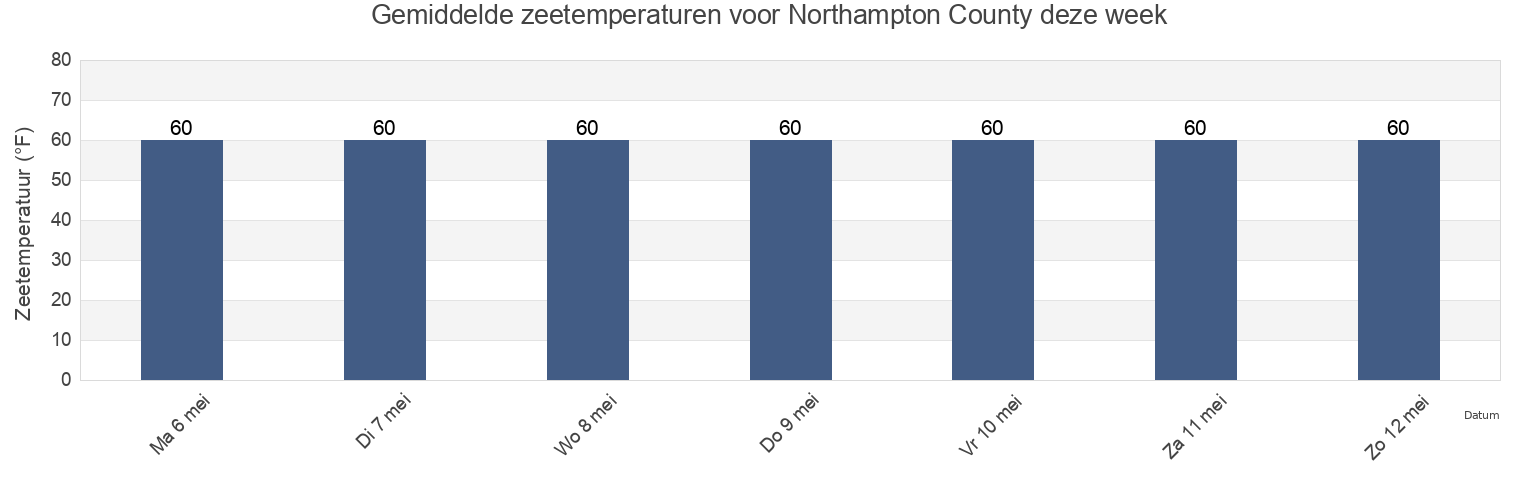
Zeetemperatuur in Northampton County
Zeetemperatuur voor Northampton County deze week
Meer getijden- en maritieme informatie voor Northampton County
Getijden vandaag
Getijden deze week
Weerbericht
Vissen tijden
Regio's en steden in Northampton County, Virginia, United States
Butler Bluff 2.1 n.mi. WSW of
Fishermans I. 0.4 mile west of
Kiptopeke Beach
Cape Charles
Fishermans I. 1.1 miles northwest of
Old Plantation Flats Lt. 0.5 mi. W of
Cape Charles City 3.3 n.mi. west of
Fishermans I. 1.4 n.mi. WNW of
Old Plantation Light
Cape Charles Coast Guard Station
Fishermans Island
Oyster Harbor
Cape Charles Harbor
Fishermans Island 0.5 n.mi. SW of
Sand Shoal Inlet (coast Guard Station)
Cape Charles off Wise Point
Fishermans Island 1.4 miles WSW of
Ship Shoal Inlet
Toon meer locaties
Cherrystone Inlet
Fishermans Island 1.7 n.mi. south of
Smith Beach
Chesapeake Channel (bridge tunnel)
Fishermans Island 2.45nm south of
Smith Island (coast Guard Station)
Chesapeake Channel (Buoy '15')
Fishermans Island 3.2 miles WSW of
Smith Island Shoal southeast of
Chesapeake Channel (Buoy 15)
Great Machipongo Inlet (inside)
Wolf Trap Light 5.8 miles east of
Church Neck Point 1.9 n.mi. W of
Hog Island
Wolf Trap Light 6.1 n.mi. ENE of
Eastville
Hungars Beach
York River Entrance Channel (SE end)
Exmore
Kiptopeke
York Spit Channel N of Buoy 26
Getijden nabij Northampton County
Oyster Harbor
Eastville
Cherrystone Inlet
Cape Charles
Cape Charles Coast Guard Station
Cape Charles Harbor
Smith Beach
Hungars Beach
Sand Shoal Inlet (coast Guard Station)
Old Plantation Light